Regions
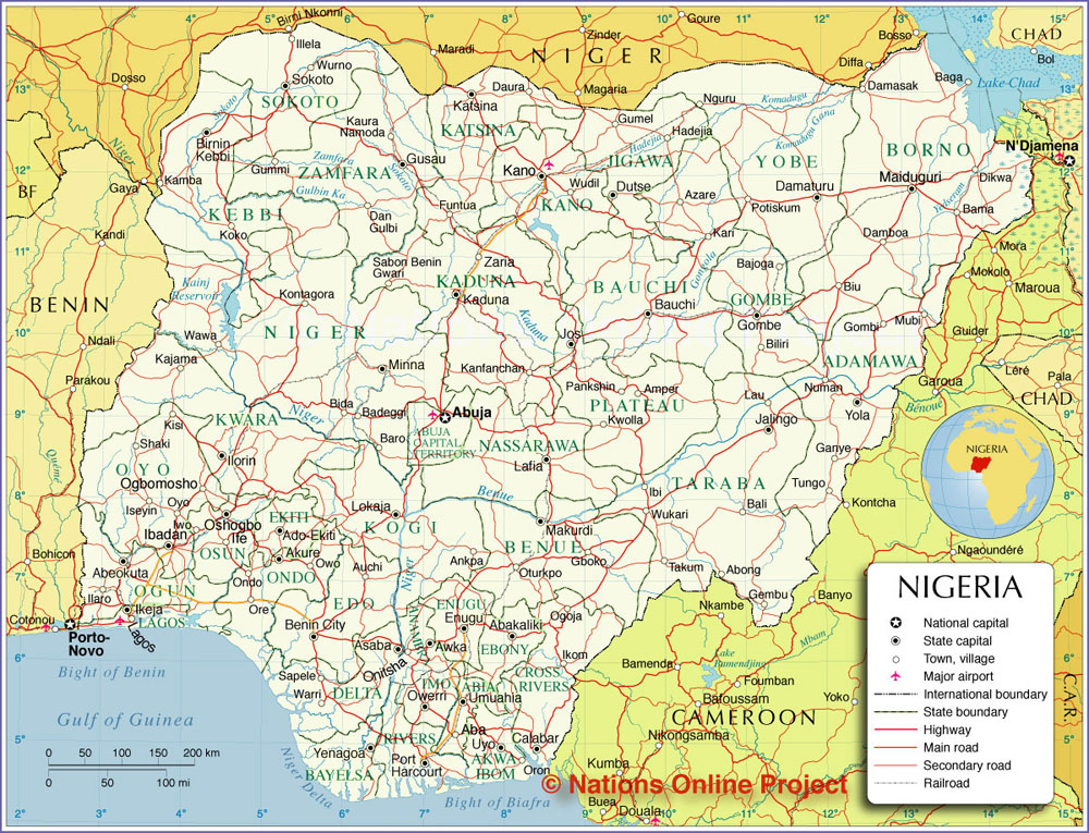
Administrative and Political Map of Nigeria
Nigeria is a country on the coast of West Africa, bordered by the Bight of Benin and the Gulf of Guinea in south, and by the Niger River in north. Nigeria is bordered by Benin, Cameroon, Chad, and Niger, it shares maritime borders with Equatorial Guinea, Ghana, and São Tomé and Príncipe.
With an area of 923,768 km² the country is more than three times the size of Italy or slightly more than twice the size of the U.S. state California. Nigeria's main rivers are the Niger and the Benue River, its highest point is Chappal Waddi with 2,419 m (7,936 ft), located in Taraba State, near the border with Cameroon.
The Federal Republic of Nigeria (its official name) has a population of 158 million people (est. 2010) making it Africa's most populous country. Capital city is Abuja located in the center of the nation, while Lagos is the primary port and largest city.
Spoken languages are English (official), Hausa, Ibo, Yoruba, and others.
The detailed map below is showing Nigeria and surrounding countries with international borders, state boundaries, the national capital Abuja, state capitals, major cities, main roads, railroads and airports.
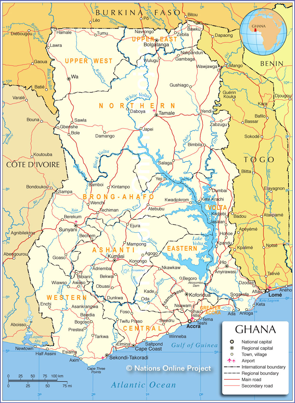
Administrative and Political Map of Ghana
Map is showing Ghana and the surrounding countries with international borders, region boundaries, the national capital Accra, region capitals, major cities, main roads, and airports.
Ghana is a divided into 10 regions:
Ashanti Region, Capital: Kumasi | Brong Ahafo Region, Capital: Sunyani | Central Region, Capital: Cape Coast | Eastern Region, Capital: Koforidua | Greater Accra Region | Northern Region, Capital: Tamale | Upper East Region, Capital: Bolgatanga | Upper West Region, Capital: Wa | Volta Region, Capital: Ho | Western Region, Capital: Sekondi-Takoradi
Border Countries: Burkina Faso, Cote d'Ivoire, and Togo